|
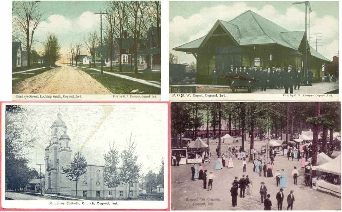
Top Left is Buckeye Street looking south about where the Integra Bank is now. This postcard
is from about 1900, when the highway was gravel!
Top right is the old B and O Railroad depot for Osgood, which was located east of Osgood Grain
mill now.
Bottom left is the Catholic Church, from about 1940. Not much has changed there except there
were trees where the parking lot is now.
The bottom right is the County Fairgrounds in 1907. They used to run 6 trains a day from Cincinnati
to Osgood for the fair. They had horse racing and beer back then!
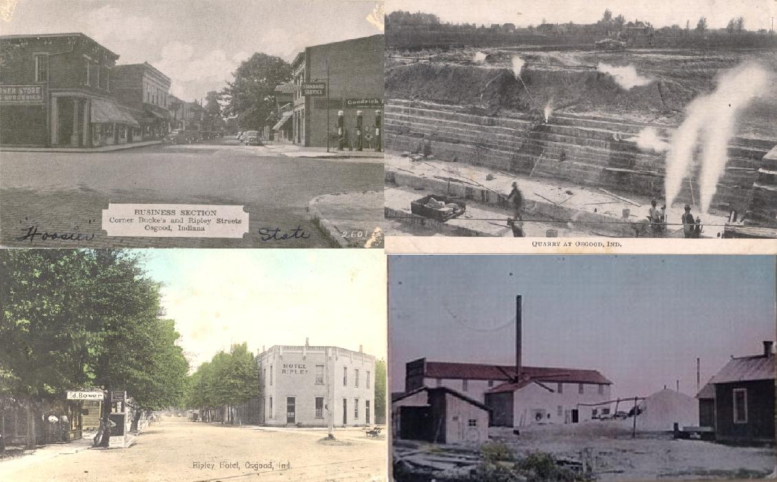
Top left is downtown Osgood at Ripley Street and Buckeye. There is a parking lot where
the building on the left was. You can see the Card and Gift gallery building.
Top right is the old quarry in Osgood. That is the water plant reservoir now.
Bottom left. Look hard at the bottom and you will see the railroad tracks, at the Main crossing.
The Ripley House was a hotel, restaurant and bar. The MINI PARK is there now.
Bottom right: This was the old lumber mill, located south of Schnieders Scrap Metal now.
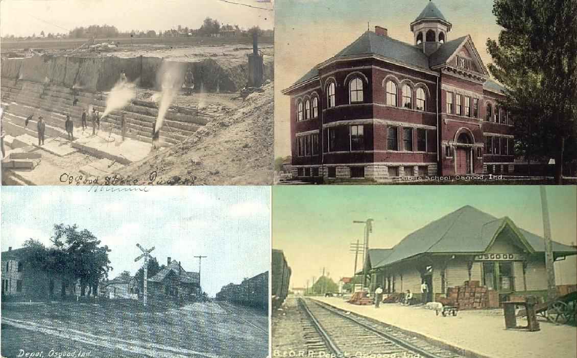
Top left: another old Osgood Quarry picture
Top right: This is the old Osgood high school, and later the elementary school. I went to
2nd, 3rd and part of the 4th grade there! (am I that old??) This is where the Osgood Firehouse is now
Bottom left: This is a 1907 card of the Osgood depot from Walnut Street looking west. The
white lines are gravel sidewalks, streets were dirt!
Bottom right: Great card of the Osgood depot. We actually took a tour of this depot
one spring morning, as the class walked from the elementary school(where the Firehouse is now) to the depot and back! Looking
to the east
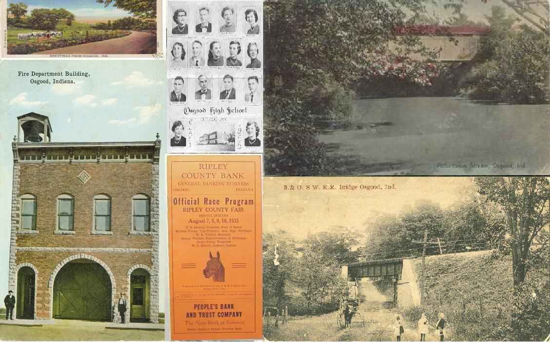 A compilation of post cards:
Top left: Generic GREETINGS FROM OSGOOD 1920s
Middle: Old Osgood High School 1955 pic
Top right: A great card of the covered bridge that was south of High Bridge, across Laughery.
A flood took the bridge out in the early 1960s.
Bottom left: 1900s -the old Osgood firehouse, now Masonic lodge.
Bottom middle: Osgood fair program from 1935
Bottom right: Yep, the Fairgrounds Av underpass in 1910. Dirt road and the horse/buggy tell
it all!
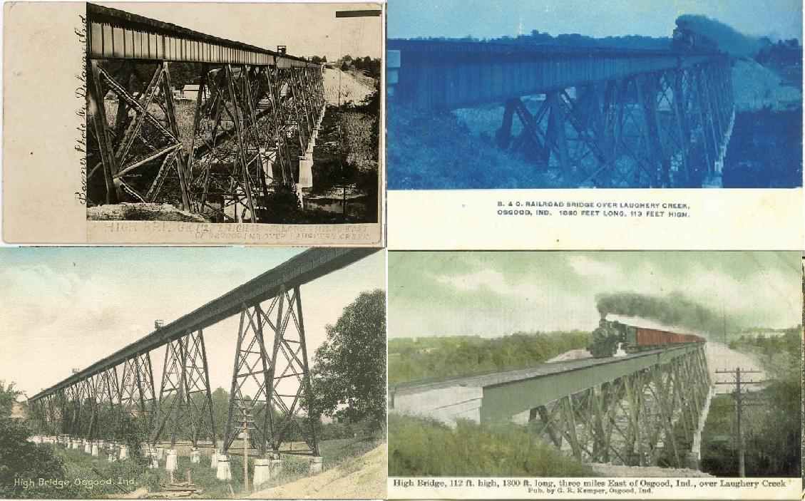
All four of these cards are of the area's major attraction in 1905. The railroad HIGH BRIDGE-
the highest bridge on the railroad at 105 feet above Laughery Creek. This bridge was built in 1905 to raise
the railroad to level grade from Osgood to Pierceville. That old railroad bed was turned over the the state and is now HIGHWAY
350!
The new railroad caused a move of the town of Delaware, to "New Delaware" on Co Rd 225 E at
the RR tracks. Many houses and buildings were built along the new tracks, but the old Delaware town that remined on the new
highway continued to thrive, and "New Delaware" never did.
|